

Before You Call a Surveyor, Try Finding Your Property Lines
 Most people reach for the phone the moment they need to know where their property lines sit. That is not always wrong. But there are a few things you can check on your own first. Some take ten minutes. Some save you a call you did not need to make.
None of these methods replace a licensed land surveyor. They are starting points, not legal answers. Still, knowing what is already out there helps you go in with a clearer picture.
Here is where to begin.
Start With Your Deed
Your deed contains a legal description of your property. This is the written language that defines your land in official terms. It usually comes in one of two forms.
The first is a lot and block description. It looks like: Lot 14, Block 3, Sunrise Heights Subdivision. That points you to a recorded plat filed with the county.
The second is a metes and bounds description. It uses compass directions and distances to trace your boundary from a starting point and back again. It reads almost like directions on paper.
Reading your deed gives you the basic framework. It tells you the shape of what you own before you step outside.
Check Your County GIS or Assessor Map
Most countries now have free online tools that show a lot of boundaries over aerial photos. In Clark County, you can access this through the County Assessor’s website. Search by your address or parcel number and your lot appears on the map.
These tools are useful for seeing your lot shape, size, and how it sits next to neighboring parcels. But they are not survey-grade. The lines shown come from recorded documents and can be off by several feet. Use them for orientation, not decisions.
Look for Markers Already in the Ground
Many residential lots already have survey monuments at the corners. They are usually iron pins, rebar, or small pipes set into the ground. Some have a small metal cap stamped with a surveyor’s number. In older areas you might find concrete posts instead.
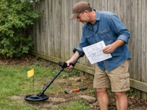
Finding them takes patience. They sit at or below ground level and are often covered by grass or soil. A basic metal detector helps. Front corners tend to show up near the street. Rear corners sit where your lot meets your neighbor’s lot.
If you find them, they give you physical anchor points to work from. If they are missing or look disturbed, that is worth noting.
Pull the Recorded Plat
If your property is in a subdivision, a plat was filed with the county when the subdivision was built. It shows the layout of every lot, the dimensions of each one, and the streets and easements in the area.
In Clark County, recorded plats are available through the County Recorder’s office or the Assessor’s mapping portal. The plat shows the intended dimensions of your lot. Comparing those against what you find on the ground tells you whether the existing markers look right.
What These Methods Cannot Tell You
Each method above gives you useful information. None of them gives you a legal answer.
County GIS maps are for reference only. Iron pins can be moved, misidentified, or placed in the wrong spot on older properties. Deed descriptions can carry errors that go back decades. Subdivision plats show design intent, not necessarily what was physically set in the field.
If you are making a legal decision, building something, or settling a disagreement with a neighbor, only a licensed land surveyor produces a result that holds up. A surveyor combines the deed, the plat, the physical markers, and field measurements into one verified record.
When to Stop and Call Someone
There are situations where going straight to a surveyor makes more sense than searching on your own.
If your markers are missing or look like they have been moved, do not guess. If your deed description is hard to follow or references points that no longer exist on the ground, a surveyor’s research will be more reliable than your read of it. And if what you find does not match what your neighbor believes, only a licensed survey resolves that with any legal weight behind it.
Looking for your own property lines is a worthwhile exercise. It makes you a more informed property owner. But when something official depends on the answer, a licensed surveyor is the right next call.
Frequently Asked Questions
Are iron pins in the ground always reliable?
Not always. Pins can be moved during landscaping or construction without anyone realizing it. They can also be set in the wrong place on older properties where original records were less precise. A pin in the ground is a clue, not a guarantee. A licensed surveyor checks whether a pin is correctly placed by comparing it against the deed, the plat, and nearby monuments.
Can I use Google Maps or satellite images to find my property lines?
No. Google Maps does not show legal property boundaries. Some apps overlay parcel outlines, but those come from county records and carry the same limitations as any GIS tool. They are fine for general orientation. They are not accurate enough for any legal or construction use.
What is the difference between a tax map and a survey?
A tax map is made for property tax purposes. It shows rough boundaries and is managed by the assessor’s office. A survey is a precise field measurement done by a licensed professional. Tax maps are not legally binding for boundary questions. A survey is.